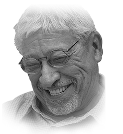
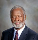
Senate President Matt Huffman, R-Lima. Photo from the Ohio Channel.
Early next month, new state legislative districts go before the Ohio Supreme Court. The congressional map approved last week is on its way to court, too. In both cases, Ohio Republicans controlled the process throughout, and approved maps that garnered no support from the minority party — directly at odds with the stated intent of the constitutional amendments overwhelmingly approved by voters. These new lines are transparently partisan, but they’re built to be right at the bleeding edge of defensible. The new Senate plan offers a glimpse at state leaders’ strategy.
Packing and cracking in Cincinnati and Cleveland
Three different state senators will represent portions of Hamilton County. Cuyahoga will get four. They’re the second and third most populous counties in the state, so splitting the counties was likely unavoidable. But political scientist David Niven takes issue with how those splits were made.
“Gerrymandering isn’t just about drawing a bunch of districts for your party to win. It’s also about drawing districts for the other party that they can’t lose,” Niven explained. “You maximize the number of their voters who are bunched together, so they harm the dominant party in as few districts as possible.”

This practice, known colloquially as packing and cracking, influences outcomes by changing what researchers call the efficiency gap. Efficiency has to do with the relative weight, or power, of a given vote. Casting a ballot in one party’s stronghold is less efficient, for instance, than casting it in a toss-up race. When the margins are tighter, a single vote means more.
According to analysis from PlanScore, the Senate map as a whole gives Republicans a nine-point edge. Dave’s Redistricting puts the efficiency gap at 11 points.
Niven says the areas around Cleveland and Cincinnati are poster children for this approach. He contrasts the 23rd District in Cleveland where Democrats can expect about 80% of the vote, with the neighboring 27th District which gives Republicans a slight edge.
“It’s almost perfectly efficient, it’s almost the ideal district from a Republican perspective, just enough Republican votes that they win — no wasted votes,” Niven said. “You know, if you put any of those Democrats from 23 into 27, and they border each other, you could do this, you would have two Democratic districts.”
In Cincinnati, Niven says Republican drafters took their tinkering with efficiency a step further. Hamilton County skews Democratic. In 2020, voters there gave Joe Biden 56% of the vote — that’s 15 points more than Donald Trump’s share. But the current map is likely to produce two Republican state senators and just one Democrat representing Hamilton County because of major differences in population.
“That’s the special sauce, it’s not only the drawing of the lines, but it’s taking liberties with the size of districts,” Niven said. “They cram quite a few more voters into the Democratic district than into the Republican districts, because if you if you apportion them evenly it would be harder to make two Republican districts.”
We're not just talking about 100 people here, 100 people there — we're talking about a 29,000 or so difference. And you know, obviously that's a strategic choice. It has absolutely nothing to do with trying to achieve fair representation. – Political Scientist David Niven
This stands in stark contrast to the process for the congressional map.
Republican lawmakers there insisted on as little population deviation as possible. Every district in the congressional map is equivalent, plus or minus one person. Sponsor Sen. Rob McColley, R-Napoleon, used an equal population argument to justify splitting Summit County. And Republicans used population as cudgel as well. Sen. Theresa Gavarone, R-Bowling Green, criticized the Democratic proposal noting one district was 748 voters above the ideal population while another was 491 voters below.
Those considerations went out the window for the Ohio Senate map.
“The Democratic district has 371,000 people. One of the Republican districts has 342,000 people,” Niven said of the Hamilton County Senate districts. “We’re not just talking about 100 people here, 100 people there — we’re talking about a 29,000 or so difference. And you know, obviously that’s a strategic choice. It has absolutely nothing to do with trying to achieve fair representation.”
It’s worth noting that courts, including the U.S. Supreme Court, have determined populations from district to district do not need to be exactly the same, and they do give greater leeway to state legislative lines. But while cases like Tennant v. Jefferson County and Reynolds v. Sims established that small deviations are fine, “as nearly as is practicable” populations must be equivalent. Further, they determined that where states do deviate, they must “justify population differences between districts that could have been avoided.”
Flipping the math outside Columbus
In 2020, Senate District 16 was decided by just 116 votes. Incumbent Sen. Stephanie Kunze, R-Hilliard, was able to fend off a challenge from first time Democratic candidate Crystal Lett.
“We were in the race for about two years,” Lett, who now works with Red, Wine and Blue, said. “It was an insanely hard-fought race. I don’t think I could have possibly worked harder than I did.”

Franklin County has grown considerably since the previous Senate map was drawn in 2011. That influx puts the district’s current population more than 12 percent higher than the ideal population, and it has also pushed the district to the left, creating more of an opening for candidates like Lett.
But the results aren’t likely to be as tight as they were in 2020 anytime soon. Under the previous map, district 16 favors Democrats over Republicans 52%-45%. With the new map, that advantage flips — favoring Republicans 52%-46%.
Mapmakers accomplished that swing by excising suburbs like Worthington that are trending blue, while adding in the entirety of largely rural Union County.
“I think the needs of Union County voters and the needs of Western Franklin County voters are significantly different,” Lett argued. “I think it’d be a huge challenge to represent both areas and represent them well. And I think that’s maybe the biggest offense of gerrymandering itself is that it lumps communities in that don’t have much in common and expects someone to be able to meet the needs of everyone that they represent.”
She also calls it “interesting” that she no longer lives in the district.
“They literally drew the line around my precinct to draw me out of the district,” she laughed. “I am by a mile no longer in Senate District 16, which I can’t imagine was done on accident.”
The six-point swing in the 16th District is actually one of the biggest on the map, but by keeping the margin within the range of what could be considered competitive, it has the sheen of fairness. Similar shifts can be seen throughout the map. While a handful of left leaning districts see their margins climb markedly, right leaning districts see their figures move slightly — sometimes up, sometimes down, but often just enough to maintain an advantage. Niven says while those changes are subtle, they’re significant.
“It’s not that far of a distance from standing on the deck of a boat to being, you know, drowning in the water a few feet away,” Niven said. “It’s not that many votes, a lean Democratic district to a lean Republican district, but it makes a world of difference.”

Sen. Kunze is term limited, so she won’t end up running in the new 16th District. Still, she doesn’t see the inclusion of Union County in her district as all that surprising given the population growth in central Ohio. And she rejects the idea that incorporating a largely rural neighboring county will change the complexion of the district. Instead, she highlights Jerome Village right across the county line from Dublin.
“That growth and influx is dynamic and increasing all the time, and to me, my little bit of time that I’ve seen and known people that moved out to Jerome village, that looks much more similar to a Franklin County (voter) than it does to a Union County voter,” Kunze said.
Niven argues the impact of those changes affect more than just the margins. He says drawing in Union County re-centers the district — pushing it away from a growth area for Democrats and toward something of a no-man’s land.
“So realistically, this would be an afterthought race for Democrats,” Niven said. “Not one that they would go into fully expecting that they could win, which is I think where it is right now.”
But Kunze and Lett are more sanguine about the district’s competitiveness. Speaking about the current GOP advantage, Kunze said, “I expect that to drop. I expect it to remain a very competitive seat.”
Although Lett believes the new district would be more challenging for Democrats, she thinks it’s still winnable.
“If I swung the district nine points in 2020, could another Democrat come in and swing the district back to having a Democrat win? I think that’s obviously possible,” she said.
And that is part of the trade off when mapmakers maximize the efficiency of one party’s votes. Although the lines are static, people aren’t. Populations shift constantly, and given enough time, margins can narrow, or even flip.
But here again, Republican lawmakers may have insulated themselves by favoring a purely partisan process. Assuming the courts allow it to take effect, the new map will only be in place for the next four years, because no Democrats voted for it. With supermajorities in both chambers, and a map that gives them an edge, the GOP’s grip on power seems unlikely to slacken before the latest map expires.
After that, Republicans can go back to the drawing board, and Ohioans could see the same process play out again.
• • •• • •


